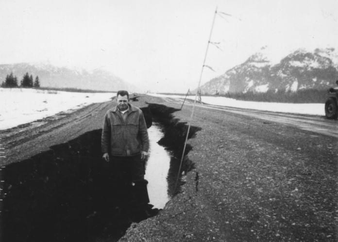
Good Friday earthquake devastated Copper River Highway

The 1964 Good Friday earthquake struck the Prince William Sound Region on March 27th. This magnitude 9.2 earthquake wrought major changes in the physical landscape of the Cordova and Prince William Sound area. Some structural damage occurred in town along the waterfront and there was one fatality at Point Whitshed; however, the tectonic uplift which took place had a much greater impact than was the case in some other Prince William Sound communities which suffered more structural damage.While the earthquake did little structural damage in town, it had a devastating effect on the Copper River Highway. All bridges between town and the airport, which crossed the delta, were either destroyed or badly damaged while the roadway itself settled differentially and was cut with fissures. At the time of the earthquake, construction on the Copper River Highway route had advanced to the Allen River at Mile 59. A survey made just after the quake showed that nearly all of the smaller bridges between Mile 27 and Mile 49 along the Copper River Highway had collapsed and one span of the Million Dollar Bridge was in the river; forcing a re-examination of the entire project.This photo came from the archives and collections of the Cordova Historical Society.

The 1964 Good Friday earthquake struck the Prince William Sound Region on March 27th.  This magnitude 9.2 earthquake wrought major changes in the physical landscape of the Cordova and Prince William Sound area. Some structural damage occurred in town along the waterfront and there was one fatality at Point Whitshed; however, the tectonic uplift which took place had a much greater impact than was the case in some other Prince William Sound communities which suffered more structural damage.

While the earthquake did little structural damage in town, it had a devastating effect on the Copper River Highway. All bridges between town and the airport, which crossed the delta, were either destroyed or badly damaged while the roadway itself settled differentially and was cut with fissures.   At the time of the earthquake, construction on the Copper River Highway route had advanced to the Allen River at Mile 59.  A survey made just after the quake showed that nearly all of the smaller bridges between Mile 27 and Mile 49 along the Copper River Highway had collapsed and one span of the Million Dollar Bridge was in the river; forcing a re-examination of the entire project.

This photo came from the archives and collections of the Cordova Historical Society.

Advertisement