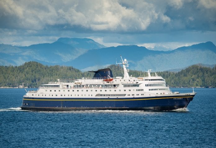
As the flagship of the Alaska Marine Highway System for over 40 years, the MV Columbia is best known for its capacity to carry up to 499 passengers, plus vehicles on its route from Bellingham, Washington, to destinations in Alaska’s Inside Passage.
Now Columbia has a dual purpose, as a research vessel with equipment on board to measure ocean temperatures, plus levels of carbon dioxide, oxygen and salt in the seawater every three minutes.
“We know that the oceans are acidifying,” said Allison Bidlack, director of the Alaska Coastal Rainforest Center at the University of Alaska Southeast.
“Most of the data we have comes from more open ocean waters. It is very rare that we have good data from inside waters,” said Bidlack, a partner in the project led by Wiley Evans, a scientist with the Hakai Institute in British Columbia.
Through continuous testing of the ocean waters along the nearly 2,000-mile route of the Columbia, marine scientists hope to learn more about the dynamics of nearshore waters and what the future holds for them as climate change continues, she said.
That will include answers on spatial variability and where to best locate various types of aquaculture.
Since the project began in November researchers have learned a lot about how variable ocean chemistry can be in some places in just three months. Now they are waiting to see results for the rest of the first year.
The aim is to detail baseline conditions from Bellingham to Skagway, said Evans, who is collaborating with Geoff Lebon at the Joint Institute of the Study of Atmosphere and Ocean at the University of Washington, which is affiliated with NOAA’s Pacific Marine Environmental Laboratory. “We need to create a baseline on conditions and seasonality of the area,” he said.
“We are the technical folks involved,” said Evans. For funding and data handling there are us and the Tula Foundation, the Alaska Ocean Observing System and Alaska Coastal Rainforest Center. The Tula Foundation is an independent charitable foundation in British Columbia whose initiatives include the Hakai Institute (https://www.hakai.org), where Evans is employed, conducting long-term scientific research at remote spots on the coast of British Columbia. AOOS (https://ioos.noaa.gov/regions/aoos/) represents a network of ocean and coastal observations, data and information products to aid understanding of the status of Alaska’s marine ecosystem.
Another partner in the research is the Sitka Tribe of Alaska, which with its partners in the Southeast Alaska Tribal Ocean Research have joined the new Alaska Ocean Acidification Network tribal research working group.
“Our involvement with the Columbia is fairly tangential,” said Esther Kennedy, an environmental specialist with the Sitka Tribe. “It’s Wiley’s project, but we’re able to compliment his research and use the ferry to ground truth our own ocean acidification monitoring,” she said.
The Sitka Tribe’s ocean acidification research efforts began one year ago, with installation of a Burke-o-Lator, an instrument invented by Oregon State professor Burke Hales, another partner in the project. The Burke-o-Lator measures multiple parameters of ocean acidification simultaneously.
Sitka Tribe researchers are monitoring several communities that the Columbia does not stop at, “but we also overlap with the Columbia route,” Kennedy said. “We hope the two data sets can be pretty closely linked. We are doing the same type of measurements.”


