
Public agencies — be they federal, state, or local — have been, and always will be, traditional targets of small-town criticism.
Sitting right in the middle of the Chugach National Forest, with a significant fleet of vehicles and vessels cruising about throughout the summer, none is fairer game for local pundits than the U.S. Forest Service.
Created in 1905, the USFS likely has been such for a long time. One of my all-time favorite books is Ivan Doig’s English Creek, the tale of a family in Medicine County, Montana that centers around Ranger Varick McCaskill and his many adventures fighting forest fires and much more near Gros Ventre, which has characters that put Cordova’s to shame.
His USFS headquarters are in Missoula, Montana, and frustrated with the amount of paperwork required to manage issues in his neck of the woods, McCaskill comments to his wife, on putting off directives to take an inventory of beaver, with “I’m waiting for policy guidance from the Mazoola inmates. They might want me to count only the tails and then multiply by one, you never know.”
Ah yes. At least computers and technology have speeded up the rate at which public agencies can generate paperwork, albeit in what seems to be increasing volumes.
Yet every now and then, despite grumbling by those who traipse and traverse Forest Service lands around Cordova, decisions from higher up the chain of command, in this case located in Anchorage, turn out to be spot on.

Two weeks ago, after closing up our duck cabin at Pete Dahl, I came up Alaganik Slough to the USFS landing, from whence all expeditions to our shack are launched.
Fortunately, a big 14-foot tide, necessary to navigate Pete Dahl Slough, which is fed by what were almost non-existent waters at that time from the Copper River at 27 Mile, did not coincide with strong southeast winds.
It was a mild and pleasant cruise up Alaganik, which is half-mile wide at its mouth, and can be brutal when the wind picks up. Longtime Cordova fisherman Jim Webber, who still calls Alaganik “The Copper” due to its pre-1964 earthquake uplift as a route all the way to the main Copper at 27 Mile, has more than once announced from what clearly is first-hand experience, “It can get pretty damn rough out there.”
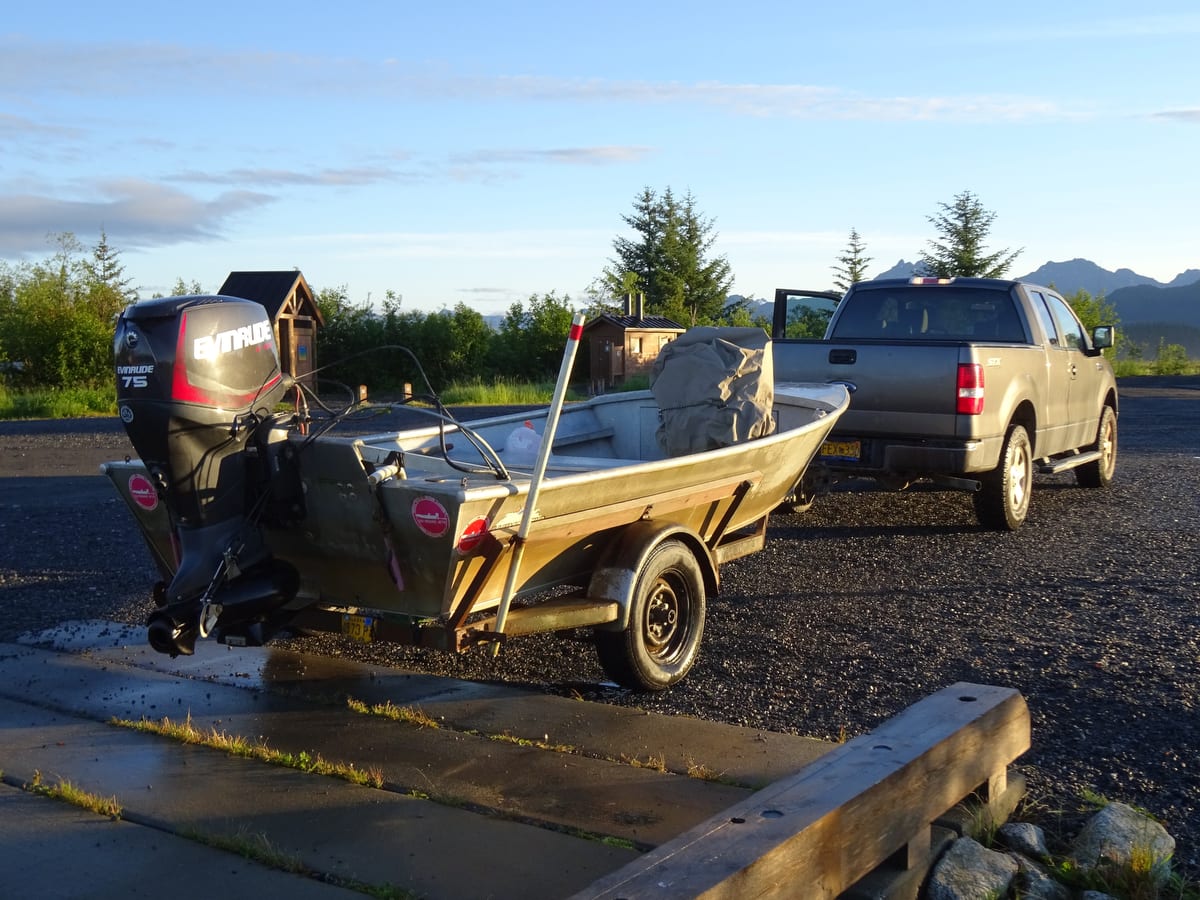
After a nice boat ride, which included a rainbow and the view of a range of mountains and glaciers that rivals the Grand Tetons or any other National Park, I pulled up to a well-designed boat ramp and launching area that the USFS completed several years ago to replace the original landing. Built in 1965 right after the earthquake, the prior ramp was a jumble of cement slabs with protruding rebar that had been torn apart by winter ice and high waters.
Then the surprising best part: a smooth drive up to the main Copper River Highway along 3.5-mile Alaganik road. Normally I dread this part of the trip even more than rough waters of Alaganik. For many years, my 14-foot river boat has taken a worse pounding from massive and unavoidable pot holes in its gravel surface than any trip up the slough.
It was the first time there was not a single pot hole of any significant size anywhere on the road, which became immediately obvious as soon as I pulled onto the main highway and started bouncing along toward the pavement starting at Mile 13.
The reason: A USFS engineering decision to put a “crown” on Alaganik Road. The creation of mud puddles and potholes is dependent on standing water, and if the water drains off the road due to a crown, no potholes.
Yes, I have heard more than a few people grouse about driving Alaganik Road on a slant, which is an inevitable consequence of “crowning” the road. Personally, I drive slowly right down the middle of the road, with tires on both sides of the crown, while carefully looking ahead for approaching vehicles.
Of course, one has to admit that an amazingly dry September may also be one of the reasons for the lack of standing water to create potholes.
It turns out one of the motivating factors in crowning the road was limited funds for grading the byway. But hey, the result was a win-win: a less bumpy road at lower maintenance cost.
And also, a reason why we should give the USFS some well-deserved praise.
So, thank you for a fine landing, and the smoothest ride my riverboat has ever had up Alaganik Road.


