A project to identify infrastructure problems on the Copper River Highway is back on track after the coronavirus pandemic delayed surveying work during 2020. The Alaska Department of Transportation’s Copper River Highway Planning and Environmental Linkages Study went public in 2019 when the department requested community input on how washed-out roads and unsteady bridges should be replaced or repaired.
Some surveying work can only be conducted around summer, when weather is more temperate. However, travel restrictions imposed around the summer of 2020 meant that numerous field excursions had to be canceled, said DOT regional hydraulics engineer Jeff Stutzke, who manages the project. But work is picking up again this year, with Kodiak Mapping Inc. personnel planning to perform a detailed survey of a washed-out area around the highway’s 44-mile marker.
“This year looks really busy,” Stutzke said. “Hopefully it’ll be a much better year this year.”
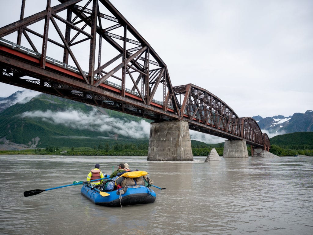
The study encompasses an area stretching roughly from mile 27-51 of the Copper RIver Highway. This area, which includes 12 bridges, has been subject to floods, earthquakes and other events putting wear and tear on infrastructure. The Miles Glacier Bridge, better known as the Million Dollar Bridge, is an area of particular concern. In 2016, a large iceberg struck the icebreaker protecting the bridge’s first pier. The damaged icebreaker was pushed downstream during a 2019 high water event, leaving the pier practically unprotected from future iceberg strikes. Maintaining the area’s existing transportation infrastructure would be “problematic at best,” according to a study draft published in 2019.
Planning and Environmental Linkage studies, or PELs, do not endeavor to fix or build infrastructure. Rather, PELs identify problems and provide cost estimates and environmental assessments for the use of future repair project organizers. In recent years, transportation departments in various states have used PELs to make the task of working on an expansive area like the Copper River Highway less daunting, Stutzke said.
“The hope is that projects will spin off of this,” Stutzke said.

The project team is evaluating recently gathered laser imagery of the mile-44 washout area, and considering where a possible new road could be built to go around the area. This evaluation work is being done in partnership with Native Village of Eyak, the Eyak Corporation and other community stakeholders, Stutzke said.
However, significant work remains to be done, and questions such as how the Million Dollar Bridge’s damaged icebreaker should be replaced remain undecided. A draft PEL, revised according to public comment and incorporating newly gathered data, will be available for public comment at the end of March, Stutzke said. The final version of the PEL is planned to be published by December at the latest, he said.
The DOT also invites public recommendations to complement or improve the existing Copper River Highway infrastructure over the next 25 years, as part of a 25-year master planning document, Stutzke said. Feedback can be submitted to Stutzke at jeff.stutzke@alaska.gov.


